
Discover the lighthouses of Orkney, where the rugged coastlines and the restless North Sea converge in a breathtaking display of nature’s power and beauty. Embark on a journey through these iconic landmarks and experience the enduring spirit of Orkney, where the land, sea, and sky meet in a harmonious blend of light and life.
Please note that some of these lighthouses offer holiday accommodation or may be privately owned.
Please take care not to trespass or drive on private property.
Orkney is a captivating blend of natural beauty, rich history, and maritime heritage off the northern coast of Scotland. This beautiful archipelago has a story stretching back thousands of years, with evidence of ancient civilizations and Norse settlers leaving an indelible mark on the landscape.
The Pentland Firth is a turbulent strait that separates Orkney from mainland Scotland. Infamous for its powerful tidal currents, it has long been a challenging passage for sailors. In contrast, Scapa Flow, a natural harbour surrounded by several Orkney islands, has played a crucial role in naval history. It was a vital anchorage for the British Royal Navy during both World Wars, providing a strategic and secure base.
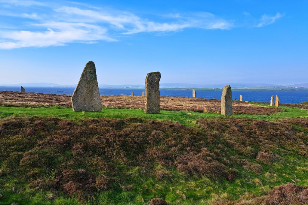
Orkney boasts many attractions that draw visitors to its shores. It uniquely blends natural wonders, historical sites, and cultural experiences. The Ring of Brodgar, a massive stone circle, and the well-preserved village of Skara Brae provide a fascinating glimpse into prehistoric life. The impressive St Magnus Cathedral in Kirkwall, often called the “Light of the North,” is a testament to Orkney’s Norse heritage. More recent additions include the Italian Chapel at Lambholm and the Churchill Barriers linking the islands.
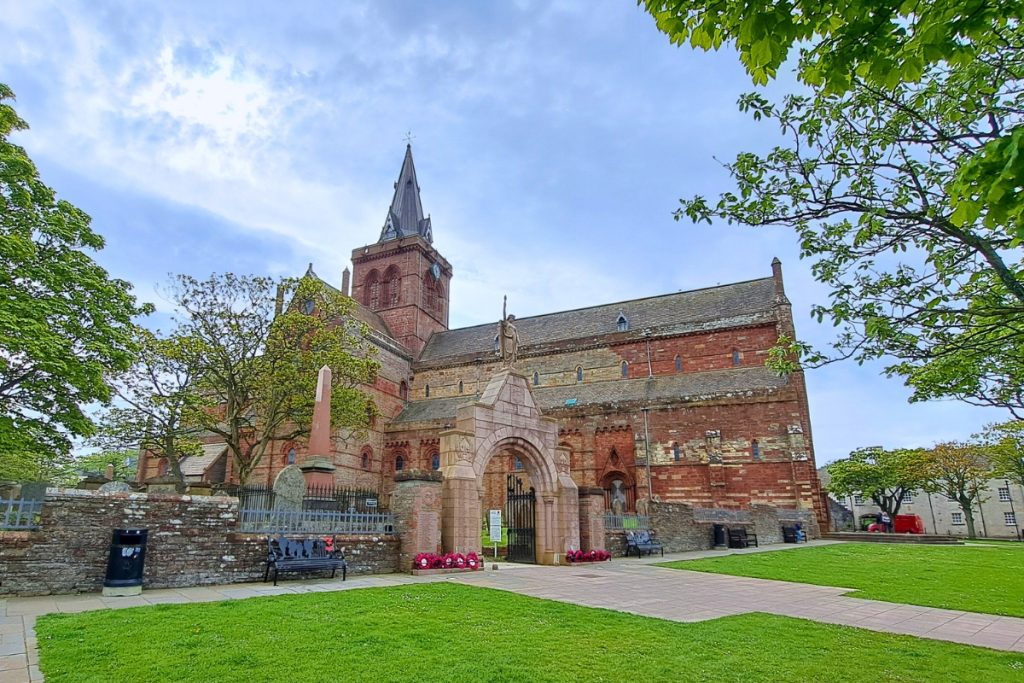
With its blend of ancient history, stunning landscapes, and vibrant culture, Orkney is a treasure trove of attractions waiting to be explored.
For thousands of years, Orkney’s position in the North Sea has made it a strategic hub for seafarers and traders. Its rich maritime history is intertwined with the lighthouses, which have played a pivotal role in guiding ships safely through the treacherous waters surrounding the archipelago. From the towering cliffs of Noup Head to the remote isles of North Ronaldsay, these lighthouses have illuminated the way for generations of sailors, ensuring their safe passage to Orkney’s shores.
Explore the incredible history of Orkney’s lighthouses, beacons of light that continue to guide sailors safely to shore.
It is only around six miles from Duncansby Head, close to John O’Groats on the mainland, to the southern end of South Ronaldsay. However, this stretch of water, the Pentland Firth, is one of the fastest-running tides in Britain. At the western end of the Firth, the Merry Men of Mey can be very turbulent.

The islands of Stroma, Swona and Muckle Skerry are located within the Pentland Firth. Stroma has a lighthouse located close to mainland Scotland and forms part of Caithness. Swona has a minor light.
The Pentland Skerries, a remote and rugged group of islets and skerries, are a prominent maritime feature off the northeastern coast of Scotland, nestled within the turbulent waters of the Pentland Firth.

Pentland Skerries Lighthouse is located on the largest and westernmost of the Pentland Skerries islands, located on Muckle Skerry, the latest of the Pentland Skerries. It was first lit in 1794 and built as a pair of lights 60 feet apart.
It can be seen from the southern tip of South Ronaldsay from the Skerries Bistro.
Sule Skerry is a remote and windswept island 40 miles west of Orkney. It stands as a stark and rugged outpost in the wild and unforgiving waters of the North Atlantic Ocean.
Despite its modest size, its location along one of the busiest and most challenging seafaring routes in the world has made it a crucial point of reference for sailors navigating the treacherous waters of the northern seas.
Sule Skerry Lighthouse was completed in 1894, taking a couple of years to build, a testament to the challenging conditions and remote location.
Hoy is the second-largest island in Orkney and is known for its rugged, dramatic landscape, including the famous sea stack, the Old Man of Hoy. It is also the wettest, highest and wildest of the Orkney islands. When approaching from the Scrabster ferry, the steep cliffs are visible, but most of Orkney is lower-lying.
The main road runs down the island’s eastern side, overlooking Scapa Flow. Hoy is accessible via ferry, and if approaching from Houton on the mainland, glimpses of Cava and Barrel of Butter Lighthouses can be seen. The latter got its name when the people of Orphir paid their annual rent of a barrel of butter to the local laird in return for permission to cull seals on the rock.
Lyness was Scapa Flow’s naval base during the Second World War. The nearby Scapa Flow Museum has lighthouse items on display.
At Longhope, to the south of Lyness, is the Longhope Lifeboat, and just down the road, the Longhope Lifeboat Museum tells the tales of heroic rescue and tragedy over the years. Most notable is the loss of the whole crew in 1969 when they went to aid the cargo ship Irene.

South Walls is connected to the southern tip of Hoy by The Ayre, a narrow causeway built over the tidal sandbank. At Kirk Hope Cemetery, a memorial is dedicated to the eight crew members of the Longhope Lifeboat who lost their lives during a 1969 rescue.
Cantick Head Lighthouse has played a crucial role in guiding ships safely through the challenging waters surrounding the Orkney Islands. The lighthouse cottages at Cantick Head are available to stay in.
Nestled between Hoy and Mainland is the small island of Graemsay. The introduction of the herring industry in the 19th century brought about the need for more navigational aids, and the Hoy Sound High and Low Lighthouses were built on opposite ends of the island in 1851.

Hoy Low Lighthouse is located on the island’s northwestern tip, Point of Oxan, where a coastal battery was built during the Second World War. Its wartime lookout remains.
Hoy High Lighthouse is on the island’s northeastern side at Taing of Sandside. The Lash, a dangerous reef, is just off the nearby Bay of Sandside.
The island is accessible via ferry from Kirkwall, first stopping at the larger island of Hoy. Returning to the mainland, you get a good view of both lighthouses from seaward.
Mainland is the largest and most populated island and the administrative and economic centre of the Orkney archipelago. Its Norse name was Hrossey, or the island of horses. Scapa Flow encompasses a scattering of connected islands.
There is plenty of evidence of Stone Age occupation, followed by broch-builders and the Picts, followed by the Norsemen in the 9th century, with a string of Norse earls.
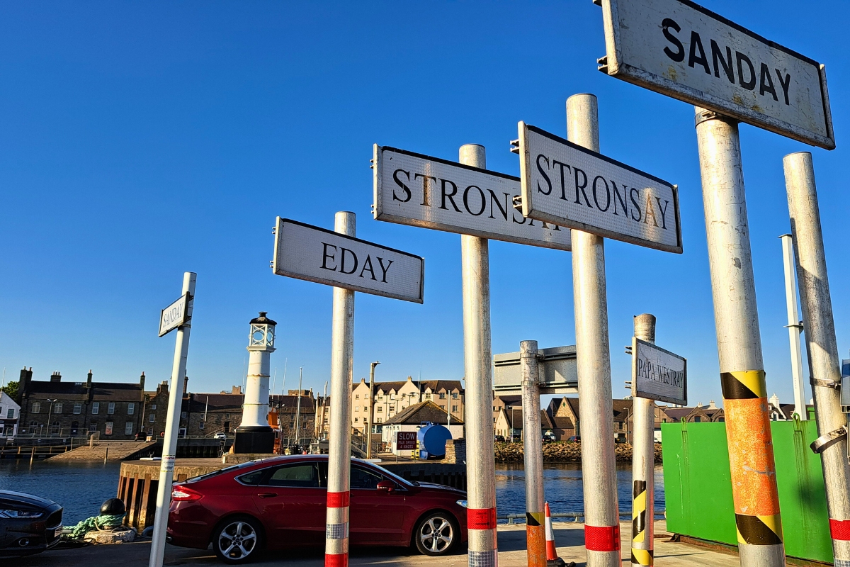
East and west Mainland are divided by a narrow stretch of land at Kirkwall, Orkney’s capital. It reached city status in the 12th century due to its prominent harbour and St Magnus Cathedral, founded in 1137. The West Pier has an ornate lighthouse dating back to 1854. The Peedie Sea formed part of the inner harbour, which was filled in during the 1800s to allow expansion to the west.
Central Mainland has prehistoric sites, with the largest concentration around Harray and Stenness. The Stenness standing stones are impressive, with one of the remaining four stones over 5 metres tall. About a mile north is the larger site of the Ring of Brodgar, which has 27 out of the original 60 stones still standing. There is a moated walkway around the site, so you can walk around them.
West of Kirkwall, Stromness is the main terminal for the ferry from Scrabster, at the southern end of the western Mainland. Home to poet and writer George Mackay Brown, it was once a prominent port but less so today. It was once the base for the Hudson Bay Company and the supply base for the Davis Strait whaling fleet.
Stromness once housed the depot for the Northern Lighthouse Board, and buildings along the quay at the former depot show telltale NLB signs. Just along from the depot is the excellent Stromness Museum, which is almost tardis-like inside despite its small exterior and houses various lighthouse-related artefacts and archives.
Further along Ness Road is the former Sule Skerry shore station, and on the road just behind, accessible via a footpath onto the back road, are the former shore stations for several Orkney lighthouses, still distinguished by their name plates, and all with their distinctive access steps.
Just north of Stromness is the site of Skara Brae, a prehistoric village dating from c. 3100 BC that was only discovered in the 1820s.

On the northwestern corner of the Mainland is Birsay, connected to the tidal isthmus to Brough of Birsay, where the lighthouse stands. Brough of Birsay Lighthouse, built in 1925, is on the northwest coast of Mainland Orkney on an uninhabited tidal island.
Heading south from Kirkwall, the village of St Mary’s is where the first of the Churchill Barriers can be found. Blockships were strategically sunk to prevent invasion, but in 1939, a German submarine managed to avoid these and sank the HMS Royal Oak. As a result, the Prime Minister, Winston Churchill, ordered barriers to be built between the eastern islands. Italian prisoners of war built these barriers and converted one of the Nissen huts into the Italian Chapel on Lamb Holm.
Churchill Barrier 2 crosses from Lamb Holm to Glims Holm, and the next reaches Burray, where the old blockships can be seen alongside the causeway. The fourth barrier leads to South Ronaldsay, where St Margaret’s Hope is the ferry terminal from Gills Bay.
The barriers were built primarily using large concrete blocks and stones. They were constructed to prevent enemy submarines from entering Scapa Flow, a major anchorage for the British Royal Navy during World Wars I and II.
To the west of St Margaret’s Hope is Hoxa Head, where Thorfinn Skull-splitter is said to be buried. There is a SPLAT (solar-powered lattice aluminium tower) here, but the previous Hoxa Head Lighthouse is now at the Museum of Scottish Lighthouses in Fraserburgh.
At the southern end of South Ronaldsay, near the harbour of Burwick, is Cleat, where the Skerries Bistro is a great stop for a cuppa. You can see Pentland Skerries and its lighthouse if the visibility is clear.
Located just offshore from Kirkwall is the island of Shapinsay. On the southern coast of the island is the tidal island of Hellier Holm. Helliar Holm Lighthouse was established in 1893. Its former optic is now displayed in the Northern Lighthouse Board Headquarters’s Stevenson Room at Edinburgh. The lighthouse is visible from various inter-island ferries.

Copinsay Lighthouse is on the eastern side of the Mainland and was the last major lighthouse to be built here, established in 1915. The island rises steeply from low lying to the cliff edges where the lighthouse is at the summit. The old farmhouse is nestled close to the jetty. The island is connected to Corn Holm at low water, but the tidal causeway is completely covered at high tide.
Just to the north of Copinsay is the Horse of Copinsay. This island has a hole through it called the Blaster Hole due to the pressure of water forced through it in stormy weather.
The island of Auskerry is a flat, grassy island with a rocky shoreline. Auskerry Lighthouse is located near the private jetty at Baa Taing. The island is around 3 miles south of Stronsay, separated by Auskerry Sound.
Hunters Geo, a gully beneath the lighthouse, was once a seal-hunting spot. The remains of the shipwreck Hastings County can be found on the shoreline; it foundered here in the 1920s.
Simon Brogan and their wife, Teresa Probert, raised their two sons on the island. Simon moved to the island in 1974 after travelling with a rock band.
Sanday is known for its beautiful beaches, especially at Start Point and Cata Sand. The low-lying island spreads out into three main peninsulas with long bays and beautiful sandy beaches. Because the island lies so low, shipwrecks were relatively common, hence the need for a navigation aid.
Sanday Heritage Centre has many interesting exhibits about island life and excellent archive material on Start Point Lighthouse. In February 2024, the remains of a shipwreck were found and are currently being maintained at the centre.
At the Bay of Loopness is the remains of a World War I wreck, a B98 German destroyer, still visible on the beach. It was hit during the Battle of Jutland on 31st May 1916.

Start Point Lighthouse is located on the island of Sanday and is the only Scottish Lighthouse with black and white stripes. Originally marked with a stone beacon, the lighthouse later replaced it in 1806. It is located on a tidal island, accessible at low water with care.
Westray, often called the ‘Queen of the North Isles’, has some impressive cliffs. At Noup Head, gannets dive and perch precariously on the rocky ledges.
Noup Head Lighthouse stands above the cliffs, and on the bumpy track up to the lighthouse are the remains of the lighthouse cottages.

On the southern side of Noup Head is Gentlemen’s Cave, where several lairds were hidden following the Battle of Culloden in 1746.
The main village of Pierowall has an excellent heritage centre worth visiting and has some excellent archives, including information about Noup Head Lighthouse. Westray Heritage Centre also has the Westray Wife, a carved stone over 5,000 years old.
The smaller island of Papa Westray claims the world’s shortest scheduled flight from Westray, lasting less than two minutes!
North Ronaldsay is the northernmost island in the Orkney archipelago. It is a low-lying island comprising a close-knit community. The island is surrounded by the Sheep Dyke, a drystone wall which keeps the famous North Ronaldsay sheep on the shoreline.
North Ronaldsay Lighthouse is Scotland’s tallest land-based lighthouse at the northernmost tip. It is possible to climb the tower and explore the visitor centre, and the lighthouse cottages are also available to rent. The nearby Dennis Beacon is also on the same headland.

On a clear day, there are some great views across Fair Isle, and Start Point Lighthouse on Sanday can also be seen.
Access to the island is by a twice-weekly ferry or via air from Kirkwall, but you need more than a day here to do it justice.
Discover more lighthouses and places to visit in Orkney